

I’ll be honest: before I stood at the mouth of a Karez well shaft in the Turpan Depression, I thought “irrigation” meant ditches and a slow-moving hose. The Karez Wells of Turpan, Xinjiang, China changed that assumption in about ten minutes. This is a 2,000-year-old underground canal network — a feat of human ingenuity that funnels snowmelt from distant mountains to thirsty farmland without losing a drop to the desert sun. To call it clever feels like calling the Great Wall “a fence.” It is engineering poetry, and it is still working today.
When I finally stepped into the cool dim of a Karez viewing gallery, the temperature dropped by what felt like fifteen degrees. Above me, the Turpan basin bakes at 40°C-plus in summer. Below, water moved quietly through a hand-built tunnel. I had read the numbers — there were once more than 1,000 Karez systems in Turpan — but standing there, listening to water you can’t see the source of, is the moment it clicks. This is not a ruin. It is a living, breathing system that feeds the vineyards where the world’s sweetest raisins are dried.
Getting There (via Turpan, Xinjiang, China)
Reaching the Karez Wells is easy once you’ve made it to Turpan, Xinjiang, China, which is itself the transport hub of the eastern Silk Road. Most travelers fly into Urumqi first and then take the high-speed train south — the trip is about an hour and a half, and you arrive right in the heart of the depression. There are also slower but scenic sleeper trains if you want the old-railway romance.
From Turpan city itself, the Karez Folk Gardens (Karez Paradise) and the main museum wells are a short taxi ride — roughly 10 to 15 minutes from the center, or a cheap didi/ride-hail. If you’re on a broader Silk Road loop, the wells sit conveniently between the city and the desert attractions, so you can pair them with an afternoon at the bazaar. I based myself in Turpan for three nights, which gave me time to visit the wells twice — once rushed, once slow — and the slow visit was the one I remember.
Coming from Kashgar or the north, you’ll pass through some of the most dramatic terrain in the region. If you’re building a route, I wrote up the larger picture in our Xinjiang travel guide and a dedicated Turpan Silk Road guide that maps the whole corridor.
What to See
The headline stop is the Karez Museum and Folk Gardens, where a glass-floored viewing corridor lets you walk above the actual underground channels. You’ll see the vertical well shafts — the “eyes” of the system — dropping straight down at regular intervals, and the gently sloping tunnel connecting them. It’s part museum, part working exhibit, and the English signage is decent.
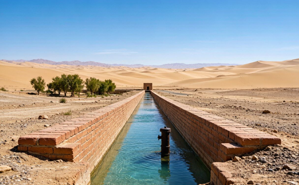
Beyond the museum, head out to the still-active fields. In the villages around Turpan, Xinjiang, China, you can watch water emerge from a Karez mouth and flood straight into grape vineyards. The contrast is the thing: bone-dry desert, then a ribbon of green fed by invisible water. I spent a long time just sitting by one such outlet, watching locals fill jugs and kids splash. There’s also a drying courtyard nearby where grapes become raisins on the same heat that the Karez tames.
Don’t skip the nearby above-ground sights while you’re here. The Flaming Mountains loom red and close, and they’re worth a stop the same day — our Flaming Mountains guide covers the best viewpoint times. And if you’re starting your trip in the regional capital, the Urumqi things to do list is a good primer.
How the Karez Works
Here’s the elegant part, and it’s simpler than you’d think. The Turpan Depression is one of the lowest, hottest, driest places in China — parts sit below sea level. Surface rivers and canals would evaporate before reaching the fields. So the builders did something brilliant: they went underground.
Snow and ice melt in the Tian Shan mountains north of the basin. Instead of channeling that water across the open desert, the Karez collects it at the mountain’s foot and runs it through a gently sloping tunnel, just below the ground, where the earth keeps it cool and shielded from evaporation. At regular intervals, vertical shafts are dug straight down to the tunnel — these let workers dig and maintain the channel, and they ventilate it. The tunnel slopes almost imperceptibly toward the fields, so gravity does the work. No pumps, no fuel, no electricity — just geometry, patience, and a terrifying amount of manual labor by people centuries ago.
I keep coming back to the labor. Some tunnels run for dozens of kilometers. Every meter was dug by hand, in the dark, with the shaft as the only way in or out. The Karez is listed among China’s great ancient engineering achievements alongside the Grand Canal, and when you see the precision of the slope, you understand why. It’s UNESCO-recognized ingenuity, and it’s the reason Turpan could grow cities and orchards in a place that should, by rights, be empty.
Tips
A few things I wish someone had told me before my first visit. Wear comfortable shoes — the museum has stairs and a long viewing corridor, and the ground outside is loose gravel. Bring water even though you’re “going underground”; Turpan’s heat is no joke, and you’ll be outside between stops.
Go early in the day if you can. The museum opens before the worst heat, and you’ll have the quiet viewing gallery mostly to yourself. A local guide or the audio tour is worth it — the system makes far more sense when someone points out which shaft is original and which was restored. Photography is allowed in most areas, but the underground sections are dim, so bump up your camera’s ISO or use a phone with night mode.
Pair the wells with a grape-valley lunch. The vineyards fed by the Karez produce spectacular fruit, and a shaded courtyard meal between two field visits was one of the best meals of my trip. If you want the full context of where this fits in a longer route, our Xinjiang 7-day itinerary slots Turpan in neatly between Urumqi and Kashgar.
Best Time
Turpan is extreme in every season, so timing matters. Spring (April to May) and autumn (September to October) are the sweet spots — warm but not lethal, and the grape harvest in late summer/early autumn is a beautiful time to see the system at full work. Summer (June to August) is brutally hot, regularly topping 40°C, but the Karez interiors stay cool, so it’s still visitable if you plan around midday. Winter is cold and quiet, with fewer crowds but also fewer outdoor demonstrations.
For the broader regional window, I’d cross-reference the best time to visit Xinjiang — the same logic that governs Turpan’s fruit season applies across the province. If you’re also heading west, a spring or autumn trip lines up perfectly with the old-town markets further down the Silk Road.
Good to Know
Entrance to the Karez Museum and Folk Gardens is modestly priced and includes the viewing corridor; combo tickets with nearby Silk Road sights are common, so ask at the booth. The site is accessible and stroller-friendly on the above-ground parts, though the deeper viewing areas have stairs. Facilities — restrooms, a small shop, and tea stalls — are on site. Turpan, Xinjiang, China is well served by trains and taxis, and most signs now carry English alongside Chinese and Uyghur.
One planning note: the Karez is best appreciated as part of a Turpan day that also includes the bazaar, the grape valleys, and the Flaming Mountains. Give yourself at least half a day. For official, up-to-date regional information — opening hours, festivals, and cultural context — the Xinjiang Culture and Tourism Department is the authoritative source I check before every trip.
If you want a high-altitude counterpoint to the desert heat, a day at the alpine lake north of Urumqi makes a perfect cool-weather bookend to a Turpan visit.