

I still remember the first morning I woke up in Kashgar. I had arrived on the overnight train from Urumqi, groggy and unsure what to expect, and stepped out into a square of pale gold light. The air felt thinner here, the shadows longer, and somewhere a vendor was already hammering copper. That single moment is why I keep telling friends that the far west of Xinjiang, China is unlike anywhere else in the country — a frontier where the Silk Road never really ended and the mountains begin to swallow the horizon.
This is the land where the Pamir and Karakoram ranges lean toward each other, where Kashgar has been a trading hub for more than two thousand years, and where the road west toward Pakistan still feels like the edge of the mapped world. If you want raw landscape and living history in one trip, this corner of Xinjiang, China delivers both.
Getting There
Reaching the far west of Xinjiang, China is half the adventure. Most foreigners fly into Urumqi first, then connect on a short domestic flight to Kashgar (Kashi) airport, which sits about ten kilometers from the old city. The flight saves you two days of train travel, but I actually recommend the sleeper train at least once — you watch the deserts of the north give way to the oasis towns of the Tarim Basin, and you arrive with a real sense of the distances involved.
Once in Kashgar, everything radiates from the old town. Taxis are cheap and metered, but the easiest way to feel the place is on foot. If you are building a wider trip, our Xinjiang travel guide covers the logistics of moving around the region, and the things to do in Urumqi page is useful if you have a layover in the capital.
Foreign visitors should note that the Kashgar region sits near sensitive border areas, so carry your passport at all times. Some mountain checkpoints require a border permit, which most hotels can help arrange. Plan an extra buffer day in case paperwork runs slow — it is worth it.
What to See: Kashgar Old Town
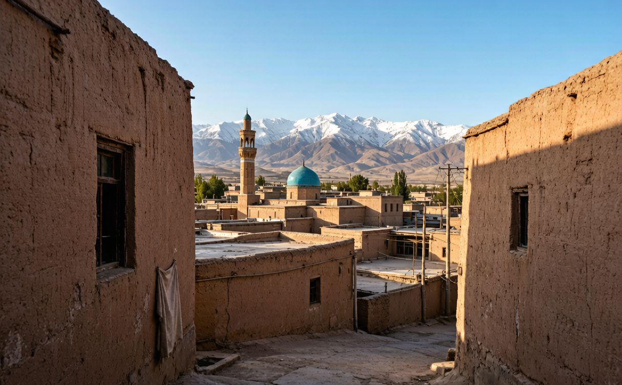
The heart of any visit is Kashgar’s Old Town (老城, Laocheng). I spent my second day simply getting lost there, and I mean that as a compliment. The lanes are a maze of mud-brick houses, carved wooden doors, and rooftop terraces where families dry grapes and watch the street below. Around every corner there is a bakery sliding flatbread into a clay oven, or a cobbler repairing boots worn thin by mountain trails.
My favorite memory is sitting on a rooftop café with a grandfather who poured me milk tea and pointed, without a word, toward the snow line. That is the old town’s gift: it does not perform for you, it just lets you watch a centuries-old rhythm keep ticking. The famous Id Kah Mosque anchors the eastern edge, and the Sunday livestock market on the city’s outskirts is chaos in the best possible way — camels, sheep, and horse traders bargaining in a dozen languages.
If you want more depth before you go, our Kashgar Old Town travel guide walks through the neighborhoods, the bazaars, and the etiquette that will make locals warmer to you.
The Mountain Roads
This is the part that earns the “where the mountains meet” in the title. From Kashgar the road climbs onto the Pamir Plateau, and within an hour the green oasis is gone, replaced by grey ridgelines and a sky so wide it feels unstable. The Karakoram Highway (the KKH) runs from Kashgar southwest toward the Khunjerab Pass and the Pakistan border, and even if you only drive the first stretch, the drama is relentless.
I hired a driver for the run up to Karakul Lake, set beneath Muztagh Ata, a glaciated peak the locals call the “Father of Ice Mountains.” At 3,600 meters the lake was flat and black, ringed by scree, and utterly silent except for wind. We passed herders moving yaks, and a small village where children waved at every car. Further along, the white cones of the Pamir proper appear, and you understand why early explorers called this the roof of the world.
The mountain roads are not for nervous passengers. They are paved but narrow, with switchbacks and the occasional rockfall. Go slow, start early, and respect altitude — I felt lightheaded above 4,000 meters and was glad I had spent a night acclimatizing in Kashgar first.
Tips
A few things I wish someone had told me before my first trip to this part of Xinjiang, China:
- Acclimatize. Spend at least a night or two in Kashgar (about 1,300 meters) before driving onto the plateau.
- Pack layers. The plateau swings from warm sun to biting wind in minutes. A windproof shell is non-negotiable.
- Carry cash. Outside Kashgar, card and phone payments are unreliable. Small notes for tea and snacks help.
- Hire a local driver. The mountain roads are demanding; a driver who knows the checkpoints saves hours.
- Respect photography etiquette. Always ask before photographing people, especially at markets and in villages.
- Learn a few words. “Rahmet” (thank you) in Uyghur opened more doors for me than any phrasebook phrase.
If you are pairing this with a classic Silk Road loop, our Turpan Silk Road guide and the Flaming Mountains near Turpan are natural companions to the Pamir leg.
Best Time
The short answer: late spring (May to June) and early autumn (September to October) are best. Summer brings the warmest road conditions and the most reliable access to high passes, but it also draws domestic crowds and the plateau can be busy. I went in early September and the weather was crisp, the light photographic, and the mountain lodges quiet.
Winter is brutal — passes can close and temperatures plunge well below freezing — but the old town under snow is hauntingly beautiful if you are hardened. Whenever you go, check conditions before heading onto the plateau, since weather changes fast at altitude. For a region-wide breakdown, our main Xinjiang travel guide covers seasonal patterns across the whole province.
Good to Know
Kashgar and the Pamir Plateau sit in the far west of Xinjiang, China, close to multiple international borders, so expect identity checks and occasional travel restrictions that shift with the season. Always travel with your passport, keep digital and paper copies of your permit, and book mountain transport a day ahead. SIM cards and internet work normally in the city, but signal weakens quickly once you climb past the last villages.
For official updates on open routes, festivals, and regional travel advisories, the Xinjiang Culture and Tourism Department is the most reliable source. I check it before every trip, because a closed pass can rewrite a whole itinerary.
Above all, come with patience. The Pamir and Kashgar reward slow travelers — the ones who sit for tea, who wait out a checkpoint, who let the mountains set the pace. That is the real secret of this corner of Xinjiang, China: you do not conquer it, you simply stand where the ranges meet and try to take it in.