

Planning a road trip through Xinjiang, China? The Duku Highway is one of the most spectacular drives in the country and, for many visitors, the single best reason to come. This Duku Highway guide explains what the road is, when it opens, how to drive it as a foreign traveller, the stops you should not miss, and the best time to point your wheels north–south through the Tian Shan.
What the Duku Highway is
The Duku Highway — short for the Dushanzi–Kuqa Highway — is a 561-kilometre mountain road that cuts straight through the heart of Xinjiang, China. In a single day behind the window you can climb from red desert canyons in the south to alpine meadows and snow-fed passes in the north, passing through landscapes that feel like several different countries stacked end to end. It connects Dushanzi, a town in the north near Karamay, with Kuqa, an oasis city on the southern edge of the Tian Shan and one of the great stops of the old Silk Road.
The road was built by the People’s Liberation Army over roughly a decade and cost hundreds of lives, which is why a martyrs’ monument stands near the northern end. Today it is fully paved, well signposted in Chinese, and widely regarded as one of the finest scenic roads in Asia. For a first-time visitor to Xinjiang, China, it is the fastest way to feel the scale of the region.
Duku Highway opening dates
The single most important fact in any Duku Highway guide is the season. Because the high passes are buried under snow for most of the year, the road typically opens in early June and closes in late September or early October. The exact dates shift with the weather each year. In warm years a southern section may open as early as late May; in cold years the northern passes may not clear until mid-June, and an early snowstorm can close things abruptly in autumn.
If you are building a Xinjiang, China itinerary around the drive, plan for a June-to-September window and confirm the current season status with a local operator before you travel. Driving the closed sections is forbidden and genuinely dangerous, and the gates are physically manned at both ends and at the high passes.
Is the Duku Highway open to foreigners?
A question we hear constantly is “is the Duku Highway open to foreigners?” The short answer is yes — foreign travellers can ride or be driven along the Duku Highway — but there are practical caveats worth knowing. First, you cannot simply rent a car and self-drive on a foreign licence in mainland China; most visitors do the drive in a hired car with a Chinese driver, or as part of an organised tour. Second, the road passes through areas where checkpoint paperwork may be required, so travelling with a reliable operator makes life far easier and solves the language barrier at the gates.
Many foreign visitors experience the Duku Highway from the comfort of a private vehicle with a local guide. That arrangement also lets you stop whenever a view demands it, which on this road is often.
Duku Highway self-drive itinerary
A sensible Duku Highway self-drive itinerary takes two to three days, with an overnight stop in the middle. Starting from the north:
- Day one takes you from Dushanzi up through the northern forests to the high passes, with a possible overnight near the Nalati grassland or in the Bayinbuluke area.
- Day two crosses the central Tian Shan and descends toward Kuqa, ending in the red-rock country of the south.
- Day three, if you have it, is best spent on the side valleys rather than rushing the main road.
Because fuel, food and phone signal are patchy in the middle section, fill up at both ends and carry water and snacks. The driving itself is not technical, but the road is narrow, busy in peak season, and shared with tour buses and cyclists, so allow generous time and resist the urge to overtake on blind corners.
Duku Highway highlights and stops
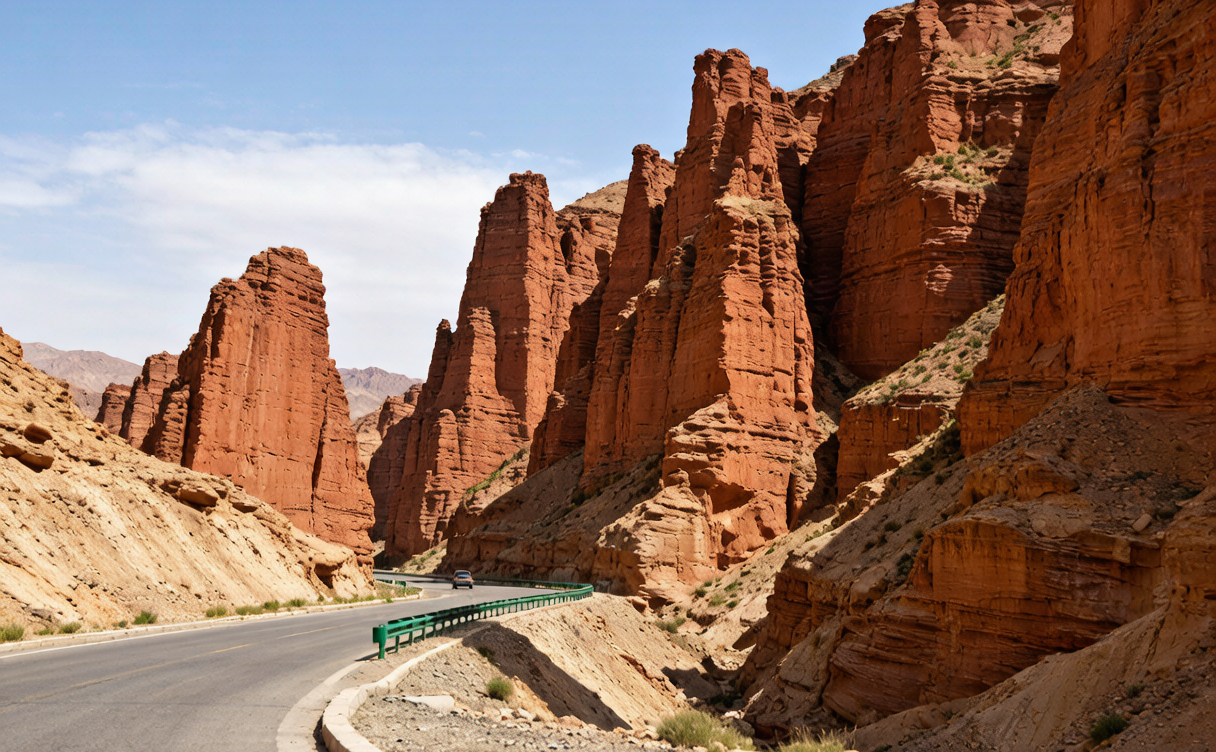
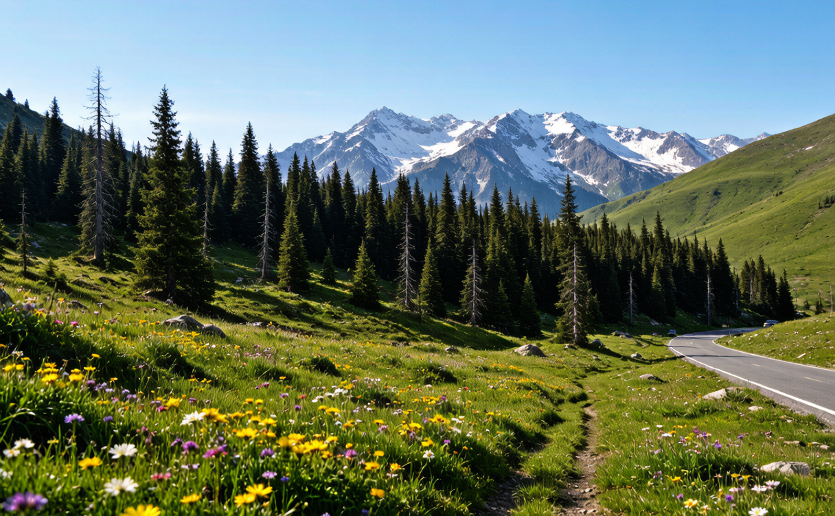
The highlights are the whole point of the trip. Near the southern end, the red sandstone canyon country around Kuqa is extraordinary — eroded fins and deep clefts in shades of rust and orange that glow at midday. Further north the road climbs into spruce forest and then above the tree line to open alpine meadow dotted with yurts and grazing herds. The highest pass, Hashilgen, often keeps snow on its verges even in high summer.
Between the two ends, the side valleys leading to the Nalati and Bayinbuluke grasslands are worth a full day each. These are the landscapes most visitors picture when they imagine Xinjiang, China: endless green slopes, winding rivers and distant snow peaks. If you continue north beyond the highway’s end, Sayram Lake is a stunning alpine lake that pairs naturally with the drive.
Best time to drive the Duku Highway
The best time to drive the Duku Highway is July and August, when the high passes are snow-free, the meadows are at their greenest, and the weather is most stable. June can still be cold at altitude, and September is beautiful as the grass turns gold but nights become freezing. Whatever month you choose, start early each day — afternoon thunderstorms are common in mid-summer, and you do not want to be on a narrow pass in a storm.
Pack for two seasons. At the northern passes you may need a fleece even in August, while the southern desert can be genuinely hot. Sunscreen, sunglasses and a refillable bottle are essential; the ultraviolet light at altitude is intense.
Practical tips for foreign travellers
- Documents: carry your passport and any permits at all times; checkpoints are frequent along the route.
- Cash: small towns may not take foreign cards, so keep some RMB on hand for snacks and fuel.
- Altitude: the passes top 3,000 metres; take it easy on your first day if you are prone to altitude sickness.
- Booking: in July and August, accommodation near the grasslands sells out, so reserve ahead through your operator.
The Duku Highway is the kind of drive people remember for years. It condenses the best of Xinjiang, China into a single, unforgettable ribbon of road, and it rewards anyone who slows down to take it in.
Where to go from the southern end
Kuqa itself deserves a day or two. The city sits on the northern branch of the Silk Road and has a celebrated bazaar, the Subashi ruins, and the nearby Kizil Caves with their early Buddhist murals. It also makes a natural jumping-off point for the Taklamakan Desert highway if you want to continue south. Many travellers pair the Duku Highway with a loop that returns via the northern grasslands and Sayram Lake before looping back to Urumqi.
Extending toward the northern grasslands
If the meadows beside the road tempt you, the Nalati grassland is the most developed and visitor-friendly of the Tian Shan pastures, with wooden walkways, horse rides and yurt stays. It is a highlight on its own and pairs naturally with the Duku drive. For a wilder alternative, the Kalajun grassland further west offers sweeping flower meadows and fewer crowds.
A longer loop through Xinjiang, China
The Duku Highway works best as one leg of a bigger journey. A popular circuit links Urumqi, Turpan, Kuqa, the Duku Highway, the northern grasslands and Sayram Lake before reaching the border towns of the northwest. Give yourself at least a week to do it justice, and consider adding the Ili Valley if your schedule allows.
Sources:
- Xinjiang Uygur Autonomous Region Government: https://www.xinjiang.gov.cn