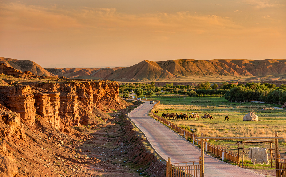

Northern Xinjiang, China has a habit of producing landscapes that look wrong for a desert country: green valleys, black limestone, turquoise lakes, and then the canyon at Dushanzi, which is the colour of a bruise. This Dushanzi Grand Canyon guide is for travellers who reach the north of the region and want the eroded strata to themselves rather than a queue at a viewpoint an hour from the airport.
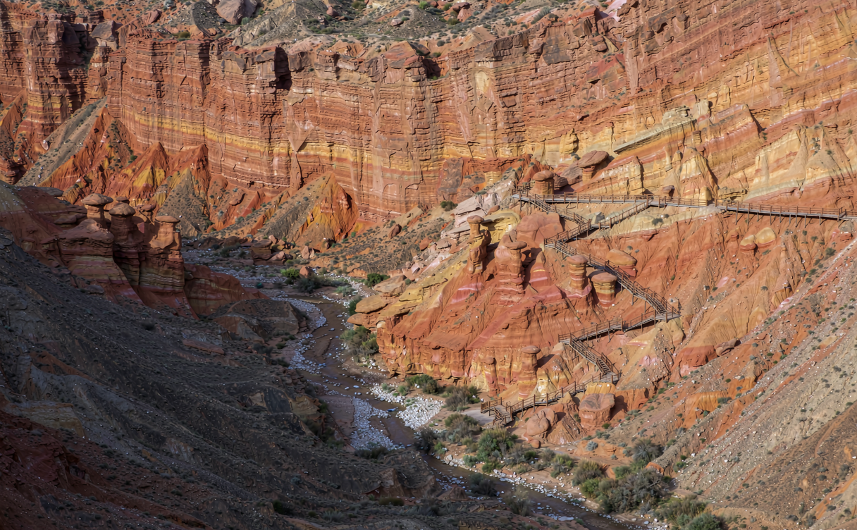
Dushanzi Grand Canyon, Xinjiang, China, is cut into the northern slope of the Tianshan by the Kuitun River over a very long stretch of geological time. The presented figures say roughly 30 million years of headward erosion, a length of about 5 to 6 km, a width near 1 km at the rim, and a depth that reaches over 100 m in the deepest section. The stripe colours are iron oxide — rust red, ochre, olive and grey — laid down in bands and then sliced vertically, which is why the walls read like a painted ribbon from the rim and like a stack of sheets from the bottom.
Decide in advance whether you are doing the canyon as a half-day detour from Urumqi or as the first stop of a northern loop toward Sayram Lake and the Duku Highway. Book the Karamay or Dushanzi hotel only after you know which one. That one decision sets the rest of this Dushanzi Grand Canyon guide.
Where the Canyon Sits
The canyon sits about 30 km south of Dushanzi district, which belongs to Karamay city, on old National Highway G217. The Dushanzi Canyon in Xinjiang, China runs a shuttle and charges a small entry fee, and you will pass a visitor centre and a row of dried-fruit shops before the road drops onto the rim and the ground falls away.
Two places get confused with each other, and the confusion costs you a day if you do not sort it out first:
- Dushanzi Grand Canyon. The managed scenic area with plank walkways, a shuttle, a fence and a fee.
- Anjihai Grand Canyon. About 60 km further south toward Shihezi, unmanaged, with the famous coloured ridges in the middle distance and access by a rough track. Some people call the pair “the Tianshan geographical gallery”. Go to Anjihai for the ridges, Dushanzi for the walkable canyon.
Dushanzi district itself is an industrial strip. It exists because of the oil refinery that has run beside the canyon road since the 1950s, and the town has no old quarter to speak of. Treat it as a bed and a base.
How to Get to Dushanzi
Dushanzi is on the Lianyungang–Khorgas expressway, so it is well connected even though it is small.
By car or hire from Urumqi. The plain answer to how to get to Dushanzi is a drive: around 250 km and three hours on the G30, comfortable and almost entirely on motorway. Public buses run the same route for a fraction of the price, but the timetable is thin and built around the refinery shift changes.
By train. There is no passenger station inside Dushanzi. Kuitun railway station is roughly 25 km north and serves the Jinghe–Yining line; from there it is a short taxi ride. Most people coming from the south find Shihezi station more convenient, then drive north.
By air. Karamay Airport is about 40 km north. It has direct flights from Urumqi, and from a handful of cities in the east in summer. Shihezi has a smaller airport about 100 km east.
For the canyon itself, the turn-off is clearly signed and easily reached from the G217 junction. Budget an hour from Dushanzi district for the rim, the walk and the shuttle queue at peak hours in August.
Best Time to Visit Dushanzi Canyon
Late June through September is when the north of the region works properly. July and August have long daylight — the sun is up until ten in the evening — and the canyon walls read at their warmest in the last hour before sunset, when the western face goes copper.
Construction and detail aside, the best time to visit Dushanzi Canyon depends on what else you want that week:
- June to September. Everything open, including the Duku Highway. Highest traffic on the rim walk.
- May and October. Quieter, cooler, and the snow line drops onto the ridges behind the canyon, which adds white to the palette. The Duku Highway usually closes from late October.
- November to April. The canyon stays open, the shuttle still runs, and you will have it almost alone. Cold, windy, and the light is flat and grey for most of the day.
- July afternoons. Local thunderstorms build over the Tianshan around four in the afternoon. Do not be at the rim when one arrives; the exposed platform and the metal railing are not a combination to test.
Pack a wind jacket even in August. The rim sits in a wind corridor and the temperature drops fast once the sun leaves the wall.
Things to Do at Dushanzi Canyon
The list of things to do at Dushanzi Canyon is short and physical.
Walk the rim plank road. The main boardwalk runs a few hundred metres along the top with three or four deep cuts visible below. It is the safest and the most photographed stretch.
Go down into a side canyon. There is a route with steps and a chain down into one of the narrower cuts. It is not technical, but the steps are uneven and the dust turns to slick clay when wet. Go in the morning.
Stay for sunset. The canyon faces west, and in the Xinjiang, China summer the Dushanzi Canyon wall colour changes completely around 9 pm for about twenty minutes before the light goes.
Combine with the Urho ghost city. The wind-eroded sandstone formations at Urho, northwest of Karamay on the road you likely already drive, are a different geology in the same day. The Urho ghost city guide for Xinjiang, China walks through timings.
A Dushanzi Canyon Itinerary for Three Days
Here is a Dushanzi Canyon itinerary that holds together without too much driving.
Day 1 — Urumqi to Dushanzi. Three hours on the motorway. Arrive before four, collect the hire car or settle into the hotel, light walk near the refinery edge so you know where you are.
Day 2 — the canyon and Urho. Morning at the rim for first light on the wall, down into the side cut by nine, back to the hotel for lunch. Afternoon drive northwest to Urho Ghost City for late afternoon, which is when the wind is up and the shapes are loud.
Day 3 — west toward Nalati or onward. If you are heading into the pasture country, the long way is via the Duku Highway and the short way is via Sayram Lake. Both are described in the Xinjiang, China travel guide.
Add a fourth day and the Nalati grassland guide will tell you how much of the valley to give it.
Pick your season now, then book the car before the hotel. If you are travelling between June and September, the Duku Highway is open and the north of the region is worth a week; if you are coming in winter, just drive in from Urumqi on a day trip and treat the canyon as an hour and a half of walking.
Where to Stay
Karamay is the proper city, with international-brand hotels, a mall and a hospital. Dushanzi district has smaller hotels and guesthouses, cheaper, and closer to the canyon turn-off. For a first visit, stay in Dushanzi if your main target is the canyon and Urho; stay in Karamay city if you want a better dinner selection and a stronger backup if something goes wrong.
Prices in July and August sit between 250 and 450 RMB for a clean double in either town, dropping toward 150 outside the season. Ask for a room away from the refinery stacks; the air is clean at altitude but the plant has a smell at night that some guests notice and most do not.
Eating Well in Dushanzi
The food here is the ordinary northern Xinjiang, China repertoire done well:
- Da pan ji (big plate chicken): chunks of free-range chicken, potato and wide noodles in a chilli and cumin sauce, served on a tray that comes to the table sizzling. Order rice or noodles underneath it.
- Laghman and 拉条子: hand-pulled noodles with a stir-fried topping. Ask for it not too spicy the first time; the heat is not the point, the cumin is.
- Samsa and flatbread: baked in a tandoor, sold from the front of shops, cheap and excellent with a vegetal tea.
- Mutton skews: charcoal grilled, cumin heavy, best after eight in the evening when the stalls fill.
Two or three skewers and a bread is a fine 25 RMB lunch. A sit-down da pan ji for two, with rice and a salad, runs 80 to 120 RMB. For the province-wide picture, the Xinjiang, China food guide explains the regional differences.
Mistakes to Avoid
Do not rent a car and plan on driving the Duku Highway in October and assuming it is open. It closes with the first heavy snow, typically from late October into June, and the closure happens without much warning locally published in English.
Do not go to the rim in sandals. The boardwalk is fine; the lower path is gravel, goat droppings and loose stone.
Do not leave valuables in the hire car at the rim. It is a popular stop and window smashing is not unknown.
Worth reading once before you arrive, the best time to visit Xinjiang, China groups the north and the south by month, and China Daily’s Xinjiang, China coverage is the most reliable English-language source for road closures and season dates.
Set the dates, book the hire car and the rim visit for early morning, then decide whether to continue west on the Duku Highway or double back to Urumqi. If you are building a two-week loop, read the Tianchi and Nalati guides first, and give the canyon a full morning rather than a sunset stop.
The canyon is an hour of walking. It is not the biggest ravine in the region and not the most dramatic — Urho has better weirdness, Anjihai has better colour. But it sits twenty minutes from a motorway turn-off and it stays open most of the year, and it is the one place in Xinjiang, China where you can stand on a plank walkway and watch the Tianshan layering fall a hundred metres below your boots.