

The Yangtze River, known in Chinese as the Chang Jiang River, is the longest river in Asia and the third longest in the world. It stretches about 6,300 kilometers (3,917 miles) from its glacial source on the Qinghai-Tibet Plateau to the East China Sea near Shanghai. As the most important waterway in the country, the Yangtze River cuts through eleven provincial-level regions and supports hundreds of millions of people. It is home to the massive Three Gorges Dam, the largest hydroelectric dam in the world, and feeds some of China’s most scenic riverside cities. Whether you want to study a map of the Yangtze, trace its source, or sail its middle reaches on a cruise, this guide gathers the essential facts you need. From its length and geography to its giant dams and the best ways to experience the riverside, here is everything travelers should know before planning a trip.
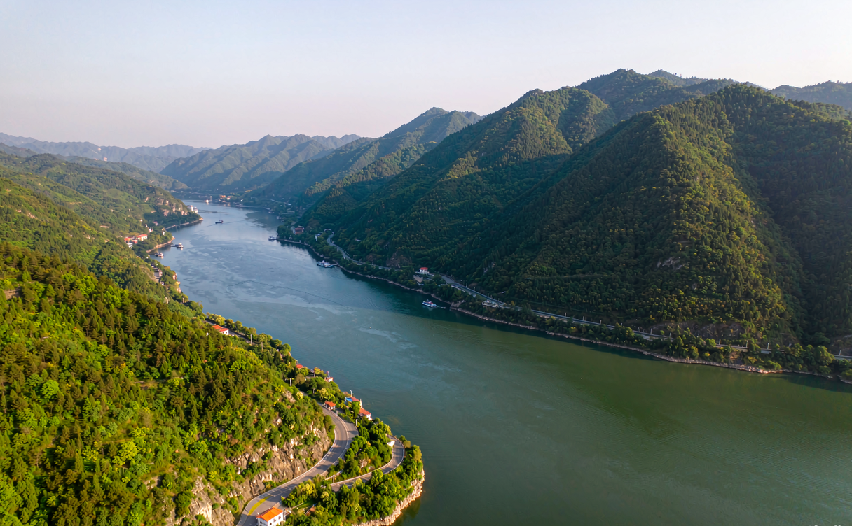
Yangtze River Length and Source
The Yangtze River is officially measured at 6,300 kilometers, making it the longest river in Asia and the third longest on Earth after the Nile and the Amazon. Its basin covers roughly 1.8 million square kilometers, about one-fifth of China’s land area, and drains water from a huge sweep of central and western China. The river is traditionally divided into the Tuotuo River headstream, the Tongtian River, the Jinsha River, and then the mainstem Yangtze as it flows past Yibin.
The source of the Yangtze River lies in the remote Tanggula Mountains on the Qinghai-Tibet Plateau, where meltwater from glaciers forms the headstream. From there the river drops dramatically in elevation before reaching the Sichuan Basin and then the broad central plains. Because the source region sits at high altitude and is difficult to reach, most travelers encounter the Yangtze much farther downstream, where it is wide, navigable, and lined with towns.
The Chang Jiang River, which simply means “Long River” in Chinese, has been the cultural and economic backbone of southern China for thousands of years. Ancient kingdoms, trade routes, and modern megacities all developed along its banks, and the river still carries more inland freight than any other waterway in the country.
Major Dams on the Yangtze
No discussion of the Yangtze is complete without its engineering landmarks. The most famous is the Three Gorges Dam, a structure so large it is visible from space. The yangtze dam in china that draws the most attention is this one, built between 1994 and 2006 near Sandouping in Hubei Province. It is the world’s largest power station by installed capacity, generating more than 22,000 megawatts. The dam created a reservoir stretching hundreds of kilometers upstream, tamed seasonal floods, and allowed large ships to reach Chongqing.
Beyond the Three Gorges, the Yangtze cascade includes several other major dams. The Gezhouba Dam, just downstream of the Three Gorges, was an earlier milestone completed in the 1980s. On the upper Jinsha River, the Xiluodu, Xiangjiaba, and Baihetan dams form one of the world’s biggest hydropower clusters. Together these projects supply a large share of China’s clean electricity and reshape how the river behaves through the seasons.
For travelers, the dams are more than engineering. The Three Gorges Dam has observation decks, ship lifts, and museums that explain the scale of the work. Many visitors combine a dam tour with a downstream or upstream cruise to see how the landscape changes around the reservoir.
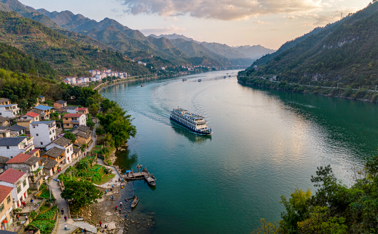
Cities Along the Yangtze Riverside
The yangtze riverside is where China’s history and modern life meet. The river passes through or borders eleven provincial-level regions, and some of the country’s most important cities grew on its banks. In the upper reaches, Chongqing is a mountainous megacity where the Yangtze meets the Jialing River; it is also the main embarkation point for cruises toward Yichang. Farther downstream, Wuhan sits at the confluence of the Yangtze and Han rivers and is famous for its bridges and lakes.
The lower Yangtze defines the wealthy Yangtze Delta. Nanjing, an ancient capital, offers riverside parks and the long Yangtze Bridge. Just downstream, Jiangyin and Zhenjiang guard the narrow mouth of the river, while Shanghai stands where the Yangtze pours into the East China Sea. The yangtze riverside in this delta region is flat, fertile, and densely populated, lined with ports, wetlands, and industrial zones that power the national economy.
Smaller towns also reward slow travelers. Yichang is the gateway to the Three Gorges, and Zhangjiajie is within a day’s reach for those who want scenery after the cruise. Riverside walks, night ferry rides, and local food markets give a feel for daily life that the big cities often overshadow.
Map of the Yangtze and Its Course
A good map yangtze travelers use will show the river’s general west-to-east path across China. The river begins in Qinghai, flows south through the mountainous border of Sichuan and Tibet, then turns east through Yunnan, Sichuan, Chongqing, Hubei, Hunan, Jiangxi, Anhui, and Jiangsu before reaching the sea at Shanghai. This long diagonal crossing is why the Yangtze is often called the dividing line between north and south China, even though the true geographic boundary is the Qinling Mountains.
When you study a map of the Yangtze, notice the major tributaries. The Min, Jialing, Han, and Wu rivers all feed the mainstem, and each adds its own color and character to the water. The famous Three Gorges — Qutang, Wu, and Xiling — sit between Chongqing and Yichang and are the scenic heart of most cruises.
Maps also help with trip planning. Distances along the river are huge, so most visitors fly into one city and cruise a section rather than attempting the whole length. A detailed map of the Yangtze makes it easy to see which cities connect by high-speed rail and which are best reached by boat.
The Best Way to Experience the River
The most popular way to see the river is a cruise through the Three Gorges, but the Yangtze offers far more than one itinerary. Our Yangtze River cruise guide explains how to choose between budget, standard, and luxury ships, and what each deck class includes. Most cruises run between Chongqing and Yichang, taking three to four nights and stopping at the dam, the gorges, and a riverside village.
If you prefer land travel, the riverside cities are linked by fast trains and good highways. You can build a loop that combines Wuhan, Nanjing, and Shanghai, or head west toward Chongqing for mountain scenery. Travelers who enjoy calmer waters might also like the Li River guide, which covers the karst landscape around Guilin and a very different kind of Chinese river trip.
For first-time visitors, timing and routing matter. Our China travel guide for first-timers walks through visas, transport cards, and how to string cities together. To match your dates with good weather, see our best time to visit China breakdown by region and season. And if you want a broader plan, our best things to do in China list highlights the river alongside temples, mountains, and food streets.
The yangtze river in asia is unmatched for scale, but the best memories come from slowing down: watching mist rise over the gorges at dawn, eating hotpot in Chongqing, or walking a quiet embankment as the ferries pass.
For deeper background on the river’s geology and history, the Wikipedia entry on the Yangtze is a reliable starting point.
Explore more of our China travel guides to plan the perfect Yangtze and beyond itinerary.
FAQ
Where does the Yangtze River start and end?
The Yangtze River starts in the Tanggula Mountains on the Qinghai-Tibet Plateau and ends at the East China Sea near Shanghai. The Chang Jiang River, as it is called in China, flows about 6,300 kilometers between these two points.
How big is the yangtze dam in china?
The main one, the Three Gorges Dam, is the largest hydroelectric dam in the world by capacity, with more than 22,000 megawatts installed. It created a reservoir hundreds of kilometers long and controls floods across the middle Yangtze.
Is the Yangtze River in Asia the longest?
Yes. The yangtze river in asia is the longest river on the continent and the third longest globally, after the Nile and the Amazon. It drains about one-fifth of China’s land.
Where can I find a good map yangtze route?
Most travel maps mark the river from Qinghai through Chongqing, the Three Gorges, Wuhan, Nanjing, and Shanghai. A detailed map of the Yangtze helps you pick cruise sections and connecting train routes.
Conclusion
The Yangtze River is more than a line on the map; it is the living artery of central China, linking snowy highlands to a crowded coastline. With a length of 6,300 kilometers, a source on the Qinghai-Tibet Plateau, and engineering feats like the Three Gorges Dam, it rewards both casual travelers and serious explorers. Use a map of the Yangtze to plan your route, pick a riverside city or a multi-day cruise, and let the chang jiang river show you a side of China that trains and planes rarely reveal.
Discover our full collection of China travel guides and start building your Yangtze adventure today.
Book-mark the Yangtze cruise guide and compare itineraries before you finalize your trip.